
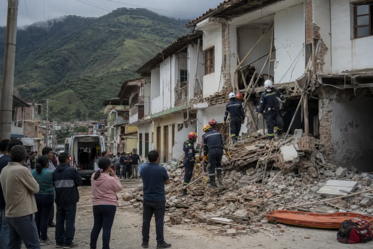
A major earthquake with a broad footprint
A magnitude 7.4 earthquake struck Colombia’s western interior on Monday, August 10, 2026, at 7:34 a.m. local time. Initial reporting placed the epicentre near San José del Palmar in the department of Chocó, roughly 400 kilometres west of Bogotá. The earthquake was felt across a wide part of Colombia and in neighbouring Ecuador and Panama.
The human consequences were already severe by the end of the day. Authorities and news agencies reported at least 111 deaths, scores of injuries and extensive building damage, while searches continued in collapsed structures. The figures were preliminary: communication failures, difficult terrain and the remoteness of some affected communities meant that the scale of losses could change as assessments reached more places.
Cali, Pereira, Manizales, Quibdó and smaller communities in the west were among the places reporting damage. Airports were temporarily closed in several cities for inspections, and hospital patients were evacuated in some locations. The effects underscored a central fact of earthquake risk: an event need not occur directly beneath a large city to cause a major urban emergency.
Why the shaking travelled so far
Early scientific accounts described the earthquake as relatively deep, with an estimated hypocentral depth of about 106 kilometres. That depth helps explain why it was felt over a large area. Seismic waves from a deeper rupture can spread through a wider volume of rock before reaching the surface, allowing people far from the epicentre to notice prolonged motion.
Depth, however, does not make a major earthquake harmless. It changes the pattern of risk. A shallow earthquake often concentrates intense ground motion close to the fault, whereas a deeper event can produce broad regional shaking. Damage then depends on more than magnitude and distance. Construction quality, the condition of individual buildings, local topography and the nature of near-surface soils can substantially alter what happens at a particular site.
Sedimentary basins can be especially important. Loose, water-rich or layered sediments may amplify certain frequencies of seismic shaking compared with nearby sites on firmer rock. This helps account for why damage can be uneven across a city or region, even when buildings are a similar distance from the source.
Magnitude itself is not a direct measure of damage. It describes the size of the rupture at its source on a logarithmic scale. A one-unit rise in magnitude corresponds to roughly ten times greater measured wave amplitude and about 32 times more energy release. The consequences on the ground are determined by how that energy travels, how long the shaking lasts and what it encounters.
A rupture in a complicated tectonic setting
Colombia sits within one of northern South America’s most complicated tectonic environments. The Nazca Plate moves beneath the South American Plate to the west, while the Caribbean Plate and smaller crustal blocks contribute additional deformation across the region. Those interacting systems generate earthquakes offshore, along faults in the Andes and within descending slabs of oceanic lithosphere.
Scientific American, citing independent earthquake scientist Amilcar Carrera-Cevallos, reported that the August 10 event was likely associated with stress within the subducting Nazca Plate rather than a rupture on the shallow plate interface. The early interpretation was consistent with the earthquake’s depth and with strike-slip motion, although a full source analysis will require additional seismic and geodetic data.
This distinction matters. The Colombia–Ecuador margin is capable of very large shallow subduction earthquakes, including the devastating 1906 event and the 1979 Tumaco earthquake. A deep intraplate event is physically different: it occurs after the oceanic plate has already descended beneath the continent, where changing pressure and temperature conditions, together with accumulated stress, can still lead to rupture.
The current earthquake should therefore not be treated as evidence that a particular future earthquake is either more or less likely. Individual earthquakes can reveal details about regional stress and wave propagation, but they do not provide a timetable for the next large event. Reliable short-term prediction of the exact time, location and magnitude of an earthquake remains beyond present science.
Interpreting claims about its historical scale
The earthquake was variously described as Colombia’s largest in the past decade and, in reporting attributed to the Colombian Geological Service, as the strongest registered in the country during the 21st century. The differing wording reflects the importance of defining the comparison period and the catalogue being used.
Either description conveys that the event was unusual in the country’s recent instrumental record. Colombia experiences frequent smaller tremors, particularly in its central and western regions, but earthquakes above magnitude 6 are much less common. The country has also endured devastating smaller events when circumstances concentrated vulnerability: the 1999 Armenia earthquake, measured at magnitude 6.2, killed more than 1,100 people.
That comparison is a reminder that magnitude alone cannot rank disasters. A lower-magnitude shallow earthquake near vulnerable buildings can be deadlier than a larger, deeper event in a less exposed location. Population density, building practice, emergency access and secondary hazards such as landslides are often decisive.
The next scientific and emergency tasks
In the immediate aftermath, aftershocks remain a practical concern. Colombia’s Geological Service reported more than 20 weaker aftershocks on the first day. Aftershock sequences commonly decline over time but can continue for weeks or longer, and stronger secondary events can further endanger damaged structures.
For response teams, the priority is life safety: search and rescue, medical care, shelter, rapid structural inspection and restoration of communications. In mountainous and heavily forested Chocó, access constraints may slow those tasks and complicate the collection of reliable damage information.
For scientists, the earthquake will yield a valuable record of a large, deep Colombian event. Seismometers can refine the location, depth and faulting mechanism; ground-motion observations can identify where local soils amplified shaking; and satellite radar may reveal whether any surface deformation accompanied the rupture. Those findings will not eliminate earthquake risk, but they can improve hazard models, building standards and preparedness for the next severe test of Colombia’s resilient but highly active geological setting.
Sources
- Colombia rocked by 7.4 magnitude earthquake—its largest in the past decade — Scientific American
- Magnitude 7.4 quake rocks western Colombia, killing at least 111 people — Associated Press
- Earthquake Magnitude, Energy Release, and Shaking Intensity — U.S. Geological Survey
- Seismicity of the Earth 1900–2007, Nazca Plate and South America — U.S. Geological Survey
- Terremotos — Colombia National Disaster Risk Management System


