
A strong signal, with an important qualification
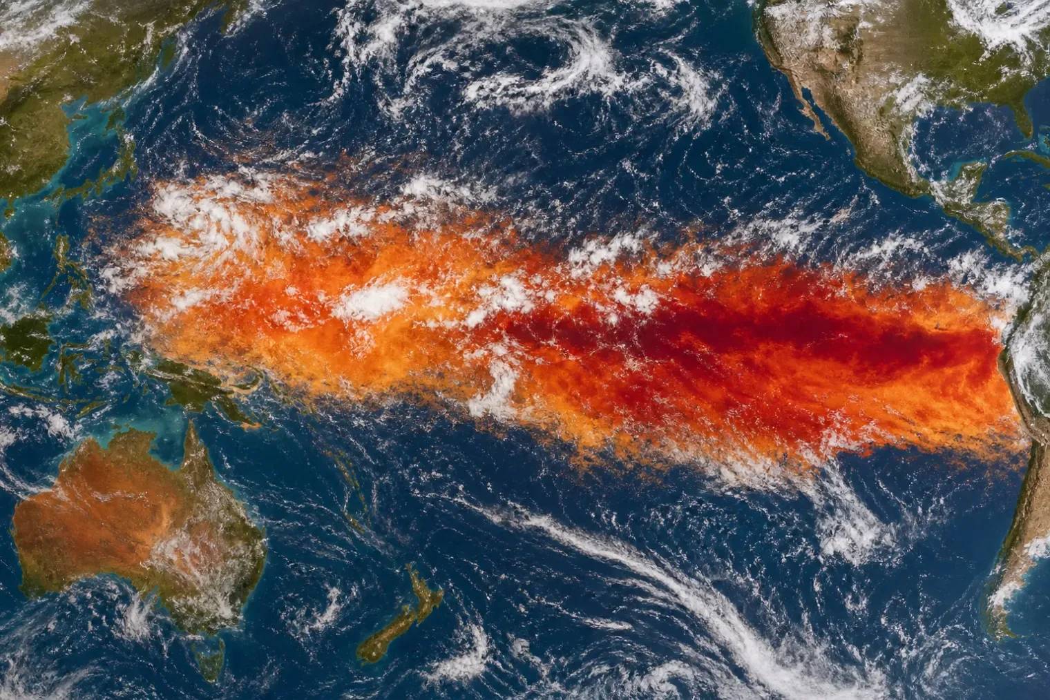
The developing El Niño in the tropical Pacific has strengthened quickly during 2026 and is now among the most closely watched climate events of the decade. Its warm waters, altered winds and shifting rainfall patterns are already producing a clearly coupled ocean–atmosphere response, the defining feature of an established El Niño.
That does not make the claim that it is unambiguously the strongest event since records began straightforward. The answer depends on what is being measured, the time period used for comparison and whether scientists are assessing current conditions or the event’s expected peak later in the year.
James Hansen and co-authors argue that the heat anomaly in the upper 300 metres of the equatorial Pacific has already exceeded that observed during the 1997–98 super El Niño. They also contend that daily sea-surface readings in the Niño 3.4 region have moved beyond earlier levels for this stage of the calendar year. This is a significant warning: unusually large subsurface heat provides energy that can sustain surface warming and reinforce atmospheric circulation changes.
However, operational agencies use standardised, multi-month indicators when classifying ENSO strength. On 13 August, the US National Oceanic and Atmospheric Administration reported a July Niño 3.4 anomaly of 1.4°C, while the eastern Niño 1+2 region reached 2.9°C. NOAA described the system as strengthening and projected more than a 90 per cent likelihood of a very strong El Niño in Northern Hemisphere autumn and winter. It did not yet designate the event as historically unprecedented.
Why different measures produce different answers
El Niño is not a single thermometer reading. It is an ocean–atmosphere pattern, and different indices are designed to capture different parts of it.
The most familiar measure is the Niño 3.4 index, which tracks sea-surface temperatures across a large area of the central-eastern equatorial Pacific. It has long been used as a practical benchmark because warming in this region is strongly connected to the atmospheric changes that spread El Niño’s effects around the world.
NOAA now also uses the Relative Oceanic Niño Index, or RONI, in its operational monitoring and forecasting. This approach adjusts the Niño 3.4 signal for warming across the broader tropical ocean, seeking to distinguish a regional El Niño anomaly from the rising global background temperature. Under NOAA’s current framework, a historic event would require a three-month RONI value of at least 2.5°C.
Hansen’s preferred indicator is different again: the accumulated heat anomaly in the upper ocean. This can capture the energy stored below the surface before it fully appears in standard sea-surface indices. It may therefore be especially informative during a rapidly evolving event, but it is not the sole operational yardstick used by forecasting agencies.
The apparent disagreement is thus less a dispute over whether the Pacific is exceptionally warm than over how to describe an event that may still be intensifying. Daily observations can set records for a particular date while a three- or five-month average remains below the peak values registered during previous super El Niños. A measure of subsurface heat can also exceed an earlier event before its surface expression does.
Forecasts point to a potentially historic peak
The stronger conclusion is forward-looking. NOAA’s August assessment put the chance of an October–December event exceeding the strongest El Niño episodes in its record since 1950 at 69 per cent. The agency also said that oceanic and atmospheric conditions had become strongly coupled, increasing confidence that the event would continue to build through the end of 2026.
The World Meteorological Organization likewise expects the event to strengthen. Its seasonal update issued at the end of July projected a rapid move towards strong conditions during August to October, with the multi-model ensemble forecasting a peak later in the year. The WMO emphasised that the combination of El Niño, unusually warm global oceans and a possible positive Indian Ocean Dipole could influence temperature and rainfall patterns across many regions.
Forecast confidence does not eliminate uncertainty. Peak intensity can be affected by short-lived wind events, the distribution of warmth across the Pacific, and the evolution of atmospheric feedbacks. Moreover, an El Niño can be extremely strong in one index without setting the same record in another. The scientifically sound description at this point is that the event is on a trajectory consistent with the largest modern episodes, rather than that every relevant record has already been broken.
What a stronger El Niño changes
El Niño alters the odds of seasonal conditions; it does not dictate the weather at every location. Its usual effects include a shift of tropical rainfall eastward across the Pacific, suppressed rainfall around Indonesia, and changes to global atmospheric circulation. NOAA has already observed enhanced convection over the central and eastern equatorial Pacific and suppressed convection over Indonesia, consistent with this pattern.
As the event matures, the strongest risks are likely to arise where El Niño’s typical influence overlaps with existing vulnerabilities. In some areas it can raise the probability of heavy rainfall, floods and landslides. Elsewhere it can increase the chance of drought, heat and wildfire-conducive conditions. Marine ecosystems may also face added stress as warmer waters intensify bleaching risk.
The effects must be interpreted alongside human-driven climate change. El Niño adds short-term variability to a climate system already warmed by greenhouse-gas emissions. This means that a familiar El Niño-related hot, wet or dry pattern may occur on a higher-temperature baseline, potentially worsening heat stress and rainfall extremes. It does not mean that every extreme event during an El Niño can be attributed to the phenomenon alone.
The value of precision
The language used to describe this event matters because “strongest ever” can imply a settled conclusion before the season has reached its likely peak. The available evidence supports a more precise assessment: 2026’s El Niño has intensified remarkably fast, has already produced exceptional readings in some measures and could become the largest event in the modern instrumental record.
That is more than enough to justify preparation. Governments, weather services and sectors exposed to climate risk should use regional forecasts rather than assume a single global outcome. The key question is no longer whether El Niño is developing, but how its growing Pacific signal will combine with a warmer world in the months ahead.
Sources
- ‘Off the charts’ El Niño is already the strongest since records began — New Scientist
- ENSO Diagnostic Discussion, 13 August 2026 — NOAA Climate Prediction Center
- Official NOAA Relative Oceanic Niño Index Outlook — NOAA Climate Prediction Center
- Strong El Niño expected to intensify — World Meteorological Organization
- Super-Duper El Nino and the Bigger Problem — Columbia University


