
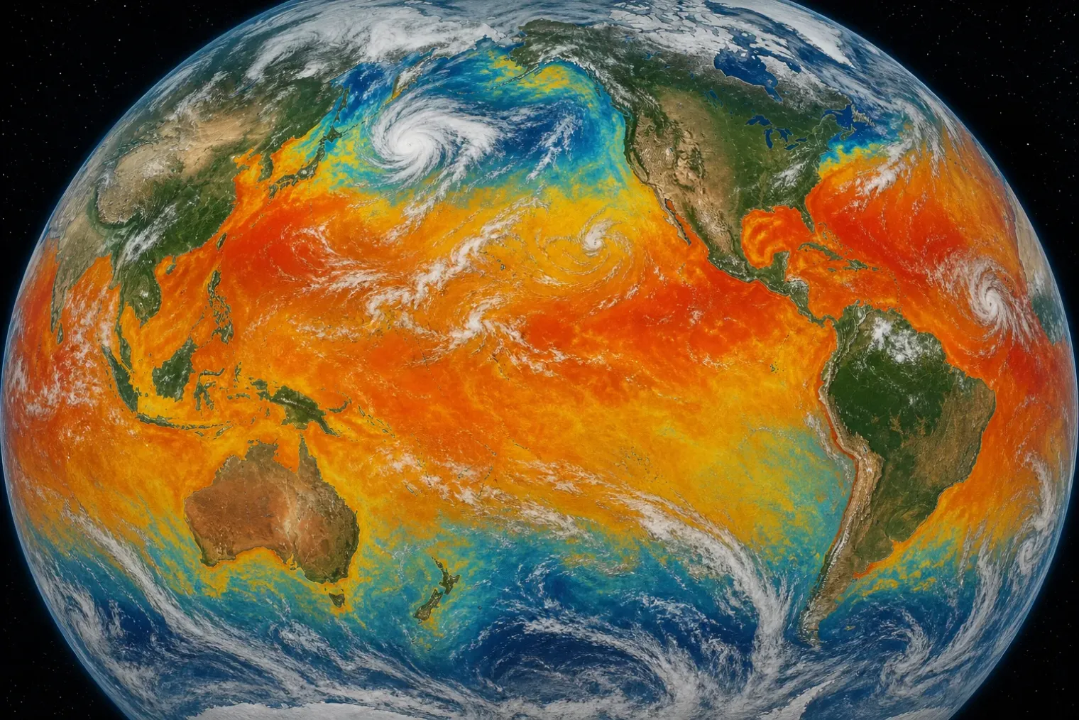
A record in the ocean’s warm season
The world’s oceans reached their highest average July surface temperature in the modern record, according to the European Union’s Copernicus climate-monitoring data. Across the extra-polar ocean, defined as waters between 60°S and 60°N, the July 2026 average was 20.96°C. That was 0.58°C above the 1991–2020 July average and above the previous July high set in 2023.
The figure matters because July is normally close to the annual high point for global sea-surface temperatures. It is therefore a test of whether the exceptional warmth seen in recent years is persisting through the seasonal cycle rather than appearing only as a brief daily anomaly. Copernicus data place the four warmest Julys in the series during 2023–2026, illustrating how rapidly the upper ocean’s baseline has shifted.
The record does not mean every ocean basin was equally warm, nor does it describe the temperature at every depth. It is an area-weighted global average of surface conditions outside the polar regions. Local conditions can differ substantially because currents, winds, cloud cover, upwelling and weather patterns redistribute heat. But an average at this level indicates that unusually warm conditions were widespread enough to influence the global result.
Long-term warming meets El Niño
The principal driver is the long-term accumulation of heat in the climate system from greenhouse-gas emissions. The ocean absorbs the great majority of that excess energy, making it the dominant reservoir for the planetary energy imbalance. Surface records are consequently part of a wider story that also includes rising ocean heat content at depth, thermal expansion of seawater and sea-level rise.
A developing El Niño in the tropical Pacific has added a shorter-term boost. El Niño is a naturally recurring climate pattern in which central and eastern tropical Pacific waters become warmer than average, changing atmospheric circulation and affecting weather far from the Pacific. The World Meteorological Organization said in June that El Niño conditions were developing and expected to influence global weather in the ensuing months.
This distinction is important. El Niño can help explain why a particular year or season is unusually hot, but it does not create the underlying long-term increase in ocean heat. Natural variability acts on top of a warmer starting point. In practical terms, the same climate pattern now unfolds in an ocean that has already accumulated decades of human-driven warming.
That relationship also cautions against treating a monthly record as a standalone measure of climate change. A single month is influenced by short-lived variations, while long-term trends are assessed across many years and through multiple indicators. Yet the July result is consistent with recent evidence that the ocean continues to store more heat and that marine heat extremes are becoming more frequent and persistent.
Why surface warmth has consequences
Warmer sea surfaces can affect ecosystems directly. Marine heatwaves, defined by persistently high temperatures relative to local seasonal conditions, can place corals, kelp forests, seagrass beds and fish populations under stress. Coral bleaching is among the most visible outcomes, but effects can extend through food webs, fisheries and coastal livelihoods. Heat can also alter where species live, changing the timing of migration and reproduction.
The atmosphere and ocean are tightly connected. A warmer ocean generally increases evaporation, supplying more moisture and energy to the atmosphere. That can influence rainfall patterns and can provide favourable fuel for intense tropical cyclones when other atmospheric conditions also support their development. It does not mean that every storm will be stronger or that ocean warmth alone determines an event’s impacts; wind shear, atmospheric structure, storm track and exposure remain crucial. Nevertheless, elevated ocean heat increases the potential available to weather systems.
Ocean warming contributes to sea-level rise in another way: water expands as it warms. This thermal expansion combines with the addition of water from melting land ice to raise global mean sea level. The consequences are particularly significant for low-lying islands and coastal communities, where a higher baseline allows storm surges and high tides to reach farther inland.
There is also a slower-moving risk beneath the surface. Heat mixed into deeper layers can persist for years or decades. This is why ocean heat content is often considered a more complete indicator of climate change than sea-surface temperature alone. Surface temperatures can fluctuate comparatively quickly, while the full ocean responds over much longer timescales.
A broader picture of July 2026
The ocean record came alongside exceptionally high global air temperatures. Copernicus found that July 2026 tied with July 2024 as the second-warmest July in its record, behind July 2023. The global average air temperature was reported at 16.9°C, only slightly below the 16.95°C recorded in July 2023.
These global averages do not translate directly into conditions in an individual country or city. Regional extremes depend on local circulation patterns, land moisture, urban development and geography. During July, persistent high-pressure conditions contributed to severe heat and drought across parts of western and central Europe. Dry soils can reinforce heat because less of the available energy goes into evaporating water and more goes into raising air temperature.
The overlap of high ocean temperatures, atmospheric heat and regional drought shows why climate risks are increasingly analysed as connected hazards rather than isolated events. Warm seas may affect marine ecosystems and weather; drought can intensify heat on land; and rising sea level can magnify the consequences of coastal storms. Each pathway has different physical causes and local effects, but they share the broader backdrop of a warming climate system.
What the record does and does not establish
July’s result is a clear benchmark, but it is not a precise forecast for the months ahead. Whether new records follow will depend partly on the evolution of El Niño, weather patterns in individual ocean basins and the normal seasonal cooling that arrives later in the year. The record also should not be interpreted as a temperature threshold beyond which a single, uniform outcome occurs.
Its significance lies in the direction and persistence of the change. The latest reading adds to evidence that exceptional ocean warmth is no longer confined to an isolated event. For researchers and decision-makers, the priority is to pair continued global observation with local preparedness: marine ecosystem monitoring, heat-health planning, water management, coastal protection and improved early warnings for weather extremes.
The ocean moderates climate change by absorbing much of the surplus heat generated by human activity. But that buffering role has costs. The July record is a reminder that the heat has not disappeared; it has moved into a system that regulates weather, supports biodiversity and shapes the safety and economies of coastal societies.
Sources
- World ocean temperatures hit extreme new record for July — Scientific American
- Copernicus Marine and Copernicus Climate Change: Daily global sea surface temperatures break records for the time of year — Copernicus
- WMO: Prepare for El Niño — World Meteorological Organization
- Earth’s climate swings increasingly out of balance — World Meteorological Organization


